Severe storms are heading for the Northeast as July begins, with a powerful system bringing damaging winds, downpours, and hail.
It will move in after the calendar flips to July, when a strong front approaches from the west on Tuesday, July 1. Storms are predicted to develop in the early afternoon and move eastward throughout the region into the evening.
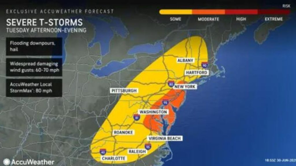
Wind gusts of more than 60 mph are possible in certain regions.
“Flooding downpours, hail and damaging wind gusts will be the primary threats in any severe thunderstorm that erupts,” according to AccuWeather meteorologist Peyton Simmers. “These thunderstorms can slow down the evening commute along parts of the I-95 corridor including in New York City, Philadelphia and Washington, DC.”
Forecasters predict that the largest dangers will be centered in the orange zones displayed on the AccuWeather map above. The strongest storms may cluster in a route extending from southeastern Pennsylvania to northeastern Virginia.
Conditions should be calm by late Tuesday night. Behind the front, drier air will move in for a period of calmer weather.
Wednesday, July 2, and Thursday, July 3, are forecast to be largely sunny, with seasonable temperatures and moderate humidity.
The forecast for Independence Day on Friday, July 4, calls for pleasant weather, with plenty of sunshine, seasonable temperatures, and lower humidity than is typical for this time of year.